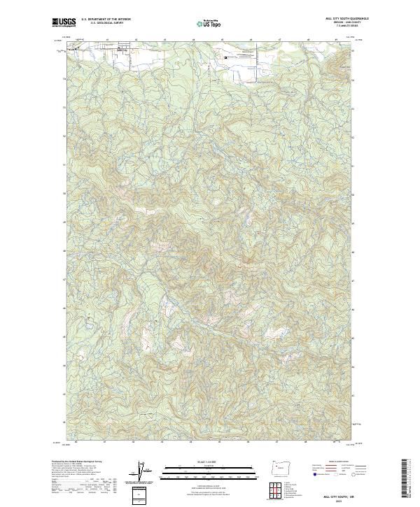
2023 Map of Mill City South
USGS Topo · Published 2023About this map
Mill City anchors the northern boundary of this Linn County landscape, where the residential streets of SW Kingwood St and SE 4th St give way to a network of drainage systems and timberlands. The terrain is defined by the winding course of Thomas Creek and its southern tributaries, including Hall Creek and Thomas Fork. To the north, the small Fairview Cem and the nearby Davis Airport sit along the transition from the settlement into the higher elevations near Potato Hill.
Find a feature on this map
35 named features on this map. Tap any name to fly to it.
Don’t see what you’re looking for? This feature index may not catch every label — zoom into the map to look around manually.
Map Details
Editions of this 2023 Mill City South Map
This is the sole edition of this map. No revisions or reprints were ever made.
Other maps of this area

1929 · Mill City
USGS Topo · 1:125,000

1951 · Lyons
USGS Topo · 1:62,500

1951 · Snow Peak
USGS Topo · 1:62,500

1953 · Salem
USGS Topo · 1:250,000

1954 · Salem
USGS Topo · 1:250,000

1955 · Mill City
USGS Topo · 1:62,500

1956 · Quartzville
USGS Topo · 1:62,500

1960 · Salem
USGS Topo · 1:250,000

1962 · Salem
USGS Topo · 1:250,000

1963 · Salem
USGS Topo · 1:250,000