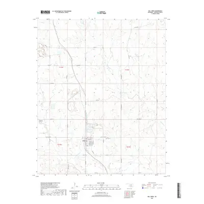
2018 Map of Mill Creek
USGS Topo · Published 2018About this map
Mill Creek serves as the central hub of this Johnston County landscape, situated at the intersection of a grid-iron street plan including S Grand Ave and E Main St. The surrounding countryside is defined by a dense network of watercourses, most notably Pennington Cr and Threemile Cr, which dictate the local topography. The map reveals a transition from the structured town blocks to broader sections of rural land marked by family-named landmarks and historical burial sites. Genealogists and local historians can locate the Alberson & Lewis Cem to the northwest and the Mill Creek Cem just east of the primary settlement. Significant transportation routes such as Frisco Rd and Chisholm Rd suggest the enduring importance of these corridors in connecting the cattle and agricultural interests of south-central Oklahoma.
Find a feature on this map
39 named features on this map. Tap any name to fly to it.
Don’t see what you’re looking for? This feature index may not catch every label — zoom into the map to look around manually.
Map Details
Editions of this 2018 Mill Creek Map
This is the sole edition of this map. No revisions or reprints were ever made.
Other maps of this area

1901 · Stonewall
USGS Topo · 1:125,000

1901 · Tishomingo
USGS Topo · 1:125,000

1957 · Ardmore
USGS Topo · 1:250,000

1963 · Ardmore
USGS Topo · 1:250,000

1963 · Sulphur South
USGS Topo · 1:24,000

1963 · Mill Creek
USGS Topo · 1:24,000

1963 · Troy
USGS Topo · 1:24,000

1963 · Nebo
USGS Topo · 1:24,000

1967 · Roff South
USGS Topo · 1:24,000

1967 · Connerville
USGS Topo · 1:24,000