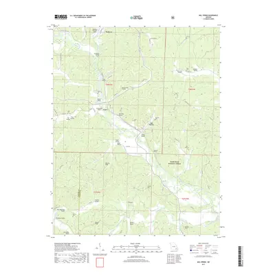
2017 Map of Mill Spring
USGS Topo · Published 2017About this map
Piedmont serves as the gateway to this portion of the Ozark foothills, where the Black River winds southward toward Leeper and Mill Spring. The map documents a landscape defined by significant topographic relief, featuring deeply carved drainages such as Stillhouse Hollow and Mining Town Hollow. Genealogy and local history are preserved through numerous family-named landmarks and burial sites, including the Kelley Cem, Bowles Cem, and Warmack Cem. The transition from the settled valley near the Piedmont Municipal Airport to the protected expanse of the Mark Twain National Forest reflects the area's timber and conservation legacy. Notable physical features like The Gulf and Bunkers Knob punctuate the ridges of Benning Ridge and Hassell Ridge, while water resources like Carter Lake and Bunyard Spring illustrate the karst-influenced hydrology of the Wayne County region.
Find a feature on this map
86 named features on this map. Tap any name to fly to it.
Don’t see what you’re looking for? This feature index may not catch every label — zoom into the map to look around manually.
Map Details
Editions of this 2017 Mill Spring Map
This is the sole edition of this map. No revisions or reprints were ever made.
Other maps of this area

1932 · Piedmont
USGS Topo · 1:62,500

1934 · Williamsville
USGS Topo · 1:48,000

1935 · Piedmont
USGS Topo · 1:62,500

1940 · Williamsville
USGS Topo · 1:62,500

1943 · Ellington
USGS Topo · 1:62,500

1944 · Grandin
USGS Topo · 1:62,500

1945 · Ellington
USGS Topo · 1:62,500

1946 · Grandin
USGS Topo · 1:62,500

1949 · Rolla
USGS Topo · 1:250,000

1953 · Rolla
USGS Topo · 1:250,000