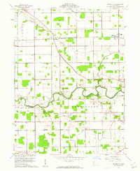
1960 Map of Miller City
USGS Topo · Published 1961About this map
Miller City and the surrounding agricultural landscapes of Putnam County are defined by a strictly surveyed grid of section lines and drainage systems. The New York Chicago and St Louis railroad cuts a diagonal path through the northwest, connecting the small settlements of Hector and Kieferville. To the south, the Blanchard River meanders across the terrain, its course flanked by localized landmarks including the Varner Cem and Myers Cem.
Find a feature on this map
30 named features on this map. Tap any name to fly to it.
Don’t see what you’re looking for? This feature index may not catch every label — zoom into the map to look around manually.
Map Details
Editions of this 1960 Miller City Map
2 editions found
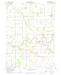
Other maps of this area

1906 · Columbus Grove
USGS Topo · 1:62,500

1908 · Columbus Grove
USGS Topo · 1:62,500

1908 · Ottawa
USGS Topo · 1:62,500

1909 · Continental
USGS Topo · 1:62,500

1911 · Delphos
USGS Topo · 1:62,500

1944 · Delphos
USGS Topo · 1:62,500

1953 · Fort Wayne
USGS Topo · 1:250,000

1953 · Muncie
USGS Topo · 1:250,000

1956 · Muncie
USGS Topo · 1:250,000

1956 · Fort Wayne
USGS Topo · 1:250,000