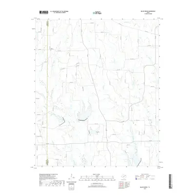
2019 Map of Miller Grove
USGS Topo · Published 2019About this map
Turkey Creek and its many tributaries, including the Middle Fork, East Fork, and West Fork, define the drainage patterns of this rural landscape in eastern Texas. The terrain is characterized by a dense network of intermittent streams and creeks such as Schooley Creek and Big Creek, which flow through a countryside crisscrossed by farm-to-market roads and county lanes. For those researching family history in the area, the map meticulously records small, localized burial grounds like Sunny Point Cemetery and Long Cemetery. The administrative boundary between Hunt and Hopkins counties runs vertically through the western portion of the sheet, dividing a landscape primarily occupied by dispersed homesteads and agricultural tracts rather than concentrated town centers. Localized landmarks like Jordan Cemetery and Bone Cemetery serve as important points of reference in this sparsely populated region.
Find a feature on this map
65 named features on this map. Tap any name to fly to it.
Don’t see what you’re looking for? This feature index may not catch every label — zoom into the map to look around manually.
Map Details
Editions of this 2019 Miller Grove Map
This is the sole edition of this map. No revisions or reprints were ever made.
Other maps of this area

1953 · Texarkana
USGS Topo · 1:250,000

1956 · Texarkana
USGS Topo · 1:250,000

1956 · Tyler
USGS Topo · 1:250,000

1956 · Emory
USGS Topo · 1:62,500

1958 · Arbala
USGS Topo · 1:24,000

1959 · Alba
USGS Topo · 1:62,500

1962 · Lone Oak North
USGS Topo · 1:24,000

1962 · Miller Grove
USGS Topo · 1:24,000

1962 · Brashear
USGS Topo · 1:24,000

1964 · Cumby
USGS Topo · 1:24,000