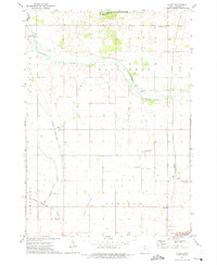
1972 Map of Miller
USGS Topo · Published 1975About this map
The Winnebago River meanders across the northern reaches of this Hancock County landscape, providing a sharp contrast to the geometric drainage patterns of the fertile agricultural land to the south. Pilot Knob State Park anchors the northern boundary, featuring the prominent Pilot Knob and the small Deadmans Lake. The settlement of Miller and the rail-oriented Hayfield Junction serve as local hubs along the Chicago Rock Island and Pacific railroad, which bisects the townships of Madison, Ellington, Garfield, and Concord. Genealogists will find a wealth of site-specific data including the St Johns Ch and several burial grounds like Pilot Knob Ch Cem and Ellington Prairie Cem. The presence of Drainage Ditch No 13 and the East Branch Iowa River illustrate the extensive land management efforts required to support the region's farming economy during this period.
Find a feature on this map
24 named features on this map. Tap any name to fly to it.
Don’t see what you’re looking for? This feature index may not catch every label — zoom into the map to look around manually.
Map Details
Editions of this 1972 Miller Map
This is the sole edition of this map. No revisions or reprints were ever made.
Other maps of this area

1954 · Mason City
USGS Topo · 1:250,000

1957 · Mason City
USGS Topo · 1:250,000

1958 · Mason City
USGS Topo · 1:250,000

1972 · Clear Lake West
USGS Topo · 1:24,000

1972 · Forest City
USGS Topo · 1:24,000

1972 · Fertile
USGS Topo · 1:24,000

1972 · Hayfield
USGS Topo · 1:24,000

1972 · Pilot Knob
USGS Topo · 1:24,000
1972 · Ventura Heights
USGS Topo · 1:24,000
1972 · Duncan
USGS Topo · 1:24,000