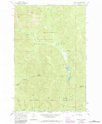
1966 Map of Miller Lake
USGS Topo · Published 1984About this map
Kootenai National Forest and Kaniksu National Forest dominate this high-elevation mountain landscape, where the drainage of East Fisher Creek feeds the prominent Miller Lake and Sylvan Lake. The terrain is characterized by a series of high summits including Owl Peak, Jumbo Peak, and Moose Peak, all connected by a network of historic forest routes. Access during this era was largely limited to rugged paths such as the Blacktail Trail (Pack) and the Moose Peak Trail (Pack), which served fire lookouts and back-country travelers before modern road development was fully realized.
Find a feature on this map
28 named features on this map. Tap any name to fly to it.
Don’t see what you’re looking for? This feature index may not catch every label — zoom into the map to look around manually.
Map Details
Editions of this 1966 Miller Lake Map
2 editions found
Other maps of this area

1920 · Jennings
USGS Topo · 1:125,000

1935 · Thompson Lakes
USGS Topo · 1:96,000

1937 · Thompson Falls
USGS Topo · 1:125,000

1942 · Thompson Lakes
USGS Topo · 1:125,000

1956 · Wallace
USGS Topo · 1:250,000

1957 · Kalispell
USGS Topo · 1:250,000

1960 · Kalispell
USGS Topo · 1:250,000

1960 · Wallace
USGS Topo · 1:250,000

1961 · Kalispell
USGS Topo · 1:250,000

1966 · Vermilion Peak
USGS Topo · 1:24,000