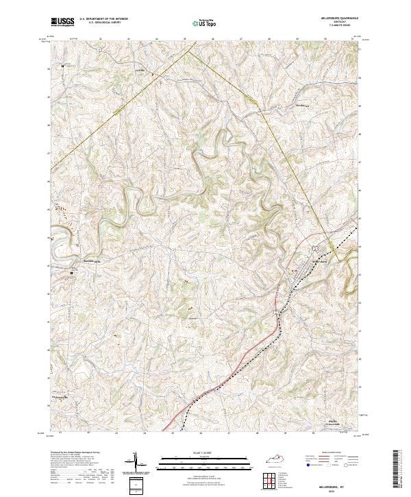
2022 Map of Millersburg
USGS Topo · Published 2022About this map
Hinkston Creek and the South Fork Licking River wind through this central Kentucky landscape, where the town of Millersburg serves as a primary hub for Bourbon County and neighboring Nicholas County. The road network radiates from the town center, including the prominent Millersburg Rd and Maysville Rd, connecting the scattered rural hamlets of Colville, Hooktown, and Blacks Crossroads. For those researching local history, the map preserves the locations of several burial grounds, such as the Old East Broadwell Cem and Ruddels Mill Cem. The settlement pattern at Ruddels Mills near the confluence of Stoner Creek illustrates the historic reliance on the area's many waterways, which also include Flat Run and Acquia Run.
Find a feature on this map
61 named features on this map. Tap any name to fly to it.
Don’t see what you’re looking for? This feature index may not catch every label — zoom into the map to look around manually.
Map Details
Editions of this 2022 Millersburg Map
This is the sole edition of this map. No revisions or reprints were ever made.
Other maps of this area

1927 · Lexington
USGS Topo · 1:48,000

1929 · Cynthiana
USGS Topo · 1:48,000

1929 · Lexington
USGS Topo · 1:62,500

1934 · Cynthiana
USGS Topo · 1:62,500

1952 · Paris East
USGS Topo · 1:24,000

1952 · North Middletown
USGS Topo · 1:24,000

1952 · Piqua
USGS Topo · 1:24,000

1952 · Shady Nook
USGS Topo · 1:24,000

1953 · Carlisle
USGS Topo · 1:24,000

1953 · Millersburg
USGS Topo · 1:24,000