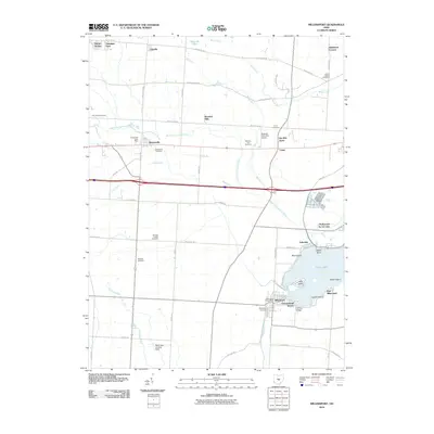
2010 Map of Millersport
USGS Topo · Published 2010About this map
Millersport and Kirkersville serve as the primary hubs in this central Ohio landscape, where the waters of Crane Lake meet a series of established residential communities. The shoreline is densely developed with neighborhoods such as Summerland Beach, Lakeside, and Hollywood by the Lake, many situated around distinctive features like Liebs Island and Castle Island. This pattern of settlement reflects the area's transition from agricultural roots to a recreation-focused destination, though the interior still maintains a rural character defined by numerous family-named roads and small cemeteries.
Find a feature on this map
54 named features on this map. Tap any name to fly to it.
Don’t see what you’re looking for? This feature index may not catch every label — zoom into the map to look around manually.
Map Details
Editions of this 2010 Millersport Map
This is the sole edition of this map. No revisions or reprints were ever made.
Other maps of this area

1907 · Thurston
USGS Topo · 1:62,500

1908 · Granville
USGS Topo · 1:62,500

1909 · Newark
USGS Topo · 1:62,500

1909 · Thornville
USGS Topo · 1:62,500

1909 · Thurston
USGS Topo · 1:62,500

1910 · Granville
USGS Topo · 1:62,500

1947 · Columbus
USGS Topo · 1:250,000

1950 · Marion
USGS Topo · 1:250,000

1958 · Carroll
USGS Topo · 1:24,000
1958 · Pataskala
USGS Topo · 1:24,000