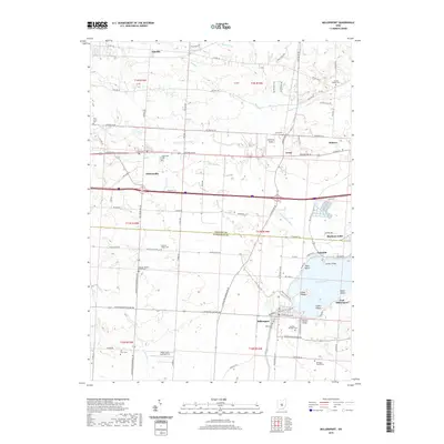
2019 Map of Millersport
USGS Topo · Published 2019About this map
Buckeye Lake and its western shoreline anchor this landscape, where the waters of Crane Lake meet established lakeside communities. The transition from the rural uplands of Licking Co to the northern reaches of Fairfield Co is marked by a network of drainage features like Beaver Run and the S Fork Licking River. Local history is deeply etched into the land through a high concentration of burial grounds, including the Bollinger Family Cem and the Refugee Baptist Smith Cem, indicating generations of family settlement.
Find a feature on this map
110 named features on this map. Tap any name to fly to it.
Don’t see what you’re looking for? This feature index may not catch every label — zoom into the map to look around manually.
Map Details
Editions of this 2019 Millersport Map
This is the sole edition of this map. No revisions or reprints were ever made.
Other maps of this area

1907 · Thurston
USGS Topo · 1:62,500

1908 · Granville
USGS Topo · 1:62,500

1909 · Newark
USGS Topo · 1:62,500

1909 · Thornville
USGS Topo · 1:62,500

1909 · Thurston
USGS Topo · 1:62,500

1910 · Granville
USGS Topo · 1:62,500

1947 · Columbus
USGS Topo · 1:250,000

1950 · Marion
USGS Topo · 1:250,000

1958 · Carroll
USGS Topo · 1:24,000
1958 · Pataskala
USGS Topo · 1:24,000