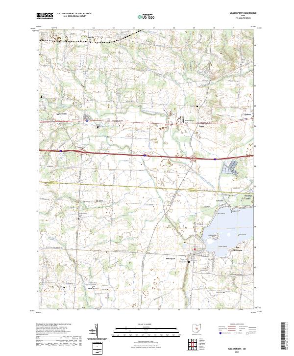
2023 Map of Millersport
USGS Topo · Published 2023About this map
Buckeye Lake and its intricate shoreline dominate the southeastern portion of this landscape, where the waters surround several named landmasses including Liebs Island, Castle Island, and Keller Island. The settlement pattern follows the historic National Rd, which carries through the villages of Kirkersville and Luray, reflecting the area's long-standing role as a transportation corridor between Columbus and Newark. Near the lake, the communities of Millersport and East Millersport are defined by a network of canals and channels, including the prominent feature known as Deep Cut. Local history and genealogy are well-represented by numerous burial sites such as Kirkersville Cem, Fletcher Chapel Cem, and the Refugee Baptist Smith Cem. The terrain is characterized by the drainage of the South Fork Licking River and its tributaries, Beaver Run and Bloody Run, which intersect a largely agricultural and residential countryside.
Find a feature on this map
83 named features on this map. Tap any name to fly to it.
Don’t see what you’re looking for? This feature index may not catch every label — zoom into the map to look around manually.
Map Details
Editions of this 2023 Millersport Map
This is the sole edition of this map. No revisions or reprints were ever made.
Other maps of this area

1907 · Thurston
USGS Topo · 1:62,500

1908 · Granville
USGS Topo · 1:62,500

1909 · Newark
USGS Topo · 1:62,500

1909 · Thornville
USGS Topo · 1:62,500

1909 · Thurston
USGS Topo · 1:62,500

1910 · Granville
USGS Topo · 1:62,500

1947 · Columbus
USGS Topo · 1:250,000

1950 · Marion
USGS Topo · 1:250,000

1958 · Carroll
USGS Topo · 1:24,000
1958 · Pataskala
USGS Topo · 1:24,000