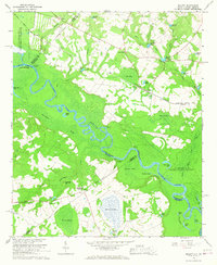
1964 Map of Millett
USGS Topo · Published 1967About this map
The U S Reservation Savannah River Plant dominates the northwestern and eastern reaches of this landscape, reflecting the mid-century expansion of federal nuclear energy facilities along the Savannah River. The river itself creates a complex web of oxbows and backwaters, including Royal Lake and Queen Lake, bordering the state line between South Carolina and Georgia. This era shows a rural network of small landings and crossroads such as Little Hell Landing and Rock Fence Crossroads that remained vital to local transit even as large-scale government operations reshaped the surrounding area.
Find a feature on this map
68 named features on this map. Tap any name to fly to it.
Don’t see what you’re looking for? This feature index may not catch every label — zoom into the map to look around manually.
Map Details
Editions of this 1964 Millett Map
2 editions found
Other maps of this area

1919 · Allendale
USGS Topo · 1:62,500

1920 · Ellenton
USGS Topo · 1:48,000

1920 · Hilltonia
USGS Topo · 1:62,500

1920 · Peeples
USGS Topo · 1:62,500

1921 · Ellenton
USGS Topo · 1:62,500

1943 · Allendale
USGS Topo · 1:62,500

1943 · Hilltonia
USGS Topo · 1:62,500

1943 · Peeples
USGS Topo · 1:62,500

1943 · Augusta East
USGS Topo · 1:125,000

1943 · Millen
USGS Topo · 1:125,000
Featured Places
- Millett, SC
- Rock Fence Crossroads, GA
- Little Hell Landing, SC
- Steel Creek Landing, SC
- Browns Landing, SC