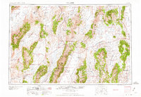
1959 Map of Millett
USGS Topo · Published 1959About this map
The Reese River and Big Smoky Valley define the central axis of this landscape, marking a period in the late 1950s when ranching and mining dictated the distribution of life across Lander and Eureka counties. While the town of Austin serves as a primary hub along U.S. 50, much of the human footprint is scattered among isolated outposts like the Santa Fe Ranch, Iowa Creek Ranch, and the McCoy Mining Camp. The map reveals the industrial transition of the era, noting the Mount Hope Mine (Abandoned) and the presence of Tungsten. High elevation landmarks such as Mt Callahan and Summit Mt tower over the Toiyabe National Forest, while the Humboldt Salt Marsh occupies the low-lying alkali flats of Dixie Valley to the west. This survey provides a spatial record of the Great Basin’s interior before more modern infrastructure replaced these family-named rangeland sites.
Find a feature on this map
107 named features on this map. Tap any name to fly to it.
Don’t see what you’re looking for? This feature index may not catch every label — zoom into the map to look around manually.
Map Details
Editions of this 1959 Millett Map
2 editions found

Other maps of this area

1907 · Tonopah
USGS Topo · 1:250,000

1908 · Tonopah
USGS Topo · 1:250,000

1908 · Carson Sink
USGS Topo · 1:250,000

1909 · Hawthorne
USGS Topo · 1:250,000

1910 · Carson Sink
USGS Topo · 1:250,000

1911 · Hawthorne
USGS Topo · 1:250,000

1915 · Hawthorne
USGS Topo · 1:250,000

1926 · Roberts Mountains
USGS Topo · 1:250,000

1929 · Roberts Mountains
USGS Topo · 1:250,000

1931 · Lovelock
USGS Topo · 1:250,000