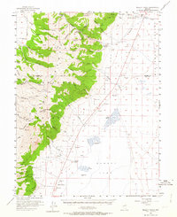
1956 Map of Millett Ranch
USGS Topo · Published 1964About this map
The high peaks of the Toiyabe Range dominate this mid-century survey, where elevation ranges from the dry floor of the Smoky Valley to the summit of Bunker Hill. This landscape is defined by the sharp transition from the Toiyabe National Forest down into the broad Alkali Flat. Human presence is concentrated at family outposts like Millett Ranch, McLeod Ranch, and Schmidtlein Ranch, which relied on the drainage from canyons such as Kingston Creek and Washington Creek.
Find a feature on this map
66 named features on this map. Tap any name to fly to it.
Don’t see what you’re looking for? This feature index may not catch every label — zoom into the map to look around manually.
Map Details
Editions of this 1956 Millett Ranch Map
2 editions found
Other maps of this area

1907 · Tonopah
USGS Topo · 1:250,000

1908 · Tonopah
USGS Topo · 1:250,000

1926 · Roberts Mountains
USGS Topo · 1:250,000

1929 · Roberts Mountains
USGS Topo · 1:250,000

1955 · Millett
USGS Topo · 1:250,000

1956 · North Shoshone Peak
USGS Topo · 1:62,500

1956 · Millett Ranch
USGS Topo · 1:62,500

1956 · Austin
USGS Topo · 1:62,500

1956 · Tonopah
USGS Topo · 1:250,000

1959 · Tonopah
USGS Topo · 1:250,000