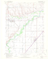
1950 Map of Milliken
USGS Topo · Published 1970About this map
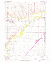
South Platte River and Big Thompson River converge in this agricultural landscape of Weld County, where a complex irrigation network supported the growth of the region's mid-century rail towns. The map documents the early 1950s infrastructure of Milliken and Gilcrest, featuring the Union Pacific and Great Western railroads that linked these settlements. A notable historical landmark, the Fort St Vrain (Ruins), sits near the confluence, marking the site of an earlier fur-trading era.
Find a feature on this map
30 named features on this map. Tap any name to fly to it.
Don’t see what you’re looking for? This feature index may not catch every label — zoom into the map to look around manually.
Map Details
Editions of this 1950 Milliken Map
6 editions found
Other maps of this area

1902 · Greeley
USGS Topo · 1:125,000

1949 · Gowanda
USGS Topo · 1:24,000

1949 · Platteville
USGS Topo · 1:24,000

1950 · Greeley
USGS Topo · 1:24,000

1950 · Gowanda
USGS Topo · 1:24,000

1950 · Platteville
USGS Topo · 1:24,000

1950 · Windsor
USGS Topo · 1:24,000

1950 · Johnstown
USGS Topo · 1:24,000

1950 · Bracewell
USGS Topo · 1:24,000

1950 · Milliken
USGS Topo · 1:24,000