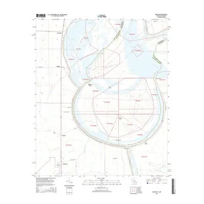
2015 Map of Millikin
USGS Topo · Published 2015About this map
The Mississippi River defines the complex hydrography and shifting boundaries of East Carroll Parish, carving out massive oxbow features and islands along the Louisiana-Mississippi border. At Bunchs Bend, the river loops dramatically around Pittman Island, a landscape shaped by historical channel migrations such as Bunchs Cutoff and Sarah Cutoff. This alluvial plain is marked by a network of bayous, including Wilson Bayou and Black Bayou, which drain the low-lying agricultural lands.
Find a feature on this map
49 named features on this map. Tap any name to fly to it.
Don’t see what you’re looking for? This feature index may not catch every label — zoom into the map to look around manually.
Map Details
Editions of this 2015 Millikin Map
This is the sole edition of this map. No revisions or reprints were ever made.
Other maps of this area

1909 · Baxter Bayou
USGS Topo · 1:24,000

1909 · Lake Providence
USGS Topo · 1:24,000

1909 · Wilsons Point
USGS Topo · 1:24,000

1909 · Millikin
USGS Topo · 1:24,000

1909 · Ashton Bridge
USGS Topo · 1:24,000

1911 · Lake Providence
USGS Topo · 1:31,680

1911 · Baxter Bayou
USGS Topo · 1:24,000

1912 · Ashton Bridge
USGS Topo · 1:31,680

1913 · Wilson Point
USGS Topo · 1:31,680

1914 · Baxter Bayou
USGS Topo · 1:31,680