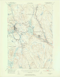
1951 Map of Millinocket
USGS Topo · Published 1956About this map
Millinocket and East Millinocket anchor this mid-century industrial landscape, where the East Branch Penobscot River meets a complex network of controlled waters. The geography is defined by the needs of the paper industry, evidenced by the Quakish Dam and the Partridge Brook Flowage. Transport and logistics are central to the area's layout, with the Bangor and Aroostook railroad tracing the river's path and the Millinocket Airport serving the town's northwestern edge. Beyond the mills, rural life is marked by the Bethel Church and small family burial grounds like Lynch Cem and Fiske Cem near Medway. The map also captures several township grants and purchases, including Hopkins Academy Grant and Indian Purchase T3, reflecting the region's historical land divisions and resource management.
Find a feature on this map
90 named features on this map. Tap any name to fly to it.
Don’t see what you’re looking for? This feature index may not catch every label — zoom into the map to look around manually.
Map Details
Editions of this 1951 Millinocket Map
4 editions found

Other maps of this area

1920 · Winn
USGS Topo · 1:62,500

1927 · Katahdin
USGS Topo · 1:48,000

1930 · Katahdin
USGS Topo · 1:62,500

1940 · Sherman
USGS Topo · 1:62,500

1940 · Mattawamkeag
USGS Topo · 1:62,500

1942 · Lincoln
USGS Topo · 1:62,500

1942 · Mattawamkeag
USGS Topo · 1:62,500

1942 · Sherman
USGS Topo · 1:62,500

1947 · Schoodic
USGS Topo · 1:62,500

1949 · Schoodic
USGS Topo · 1:62,500