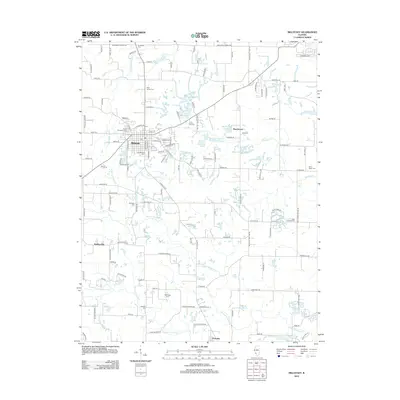
2012 Map of Millstadt
USGS Topo · Published 2012About this map
Millstadt serves as the primary hub of this landscape, its grid organized around E Mill St and S Jefferson St. The surrounding countryside is dotted with significant genealogical markers, including several rural burying grounds such as Old Millstadt Cem, Mount Evergreen Cem, and Freivogel Cem. The terrain is defined by the winding paths of Prairie du Pont Cr and W Fork Richland Cr, which carve through the farmland south of the main settlement. Small communities and family landmarks like Bohleysville, Floraville, and Oak Ridge Farm illustrate the persistent agricultural character of this part of Saint Clair County. Notable local water features including Roachtown Lake and YMCA Camp Lake further characterize the area's development outside the village core.
Find a feature on this map
127 named features on this map. Tap any name to fly to it.
Don’t see what you’re looking for? This feature index may not catch every label — zoom into the map to look around manually.
Map Details
Editions of this 2012 Millstadt Map
This is the sole edition of this map. No revisions or reprints were ever made.
Other maps of this area

1888 · St. Louis
USGS Topo · 1:62,500

1907 · Belleville
USGS Topo · 1:62,500

1910 · Waterloo
USGS Topo · 1:62,500

1912 · New Athens
USGS Topo · 1:62,500

1913 · Waterloo
USGS Topo · 1:62,500

1931 · French Village
USGS Topo · 1:24,000

1933 · Cahokia
USGS Topo · 1:24,000

1934 · Cahokia
USGS Topo · 1:24,000

1935 · French Village
USGS Topo · 1:24,000

1937 · O'Fallon
USGS Topo · 1:24,000