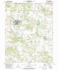
1990 Map of Millstadt
USGS Topo · Published 1991About this map
Millstadt serves as the central hub of this St. Clair County landscape, which transitions from a grid-patterned village into a network of small outlying settlements and family-named farm roads. The map reveals the intricate social fabric of the late 20th-century countryside, where institutions like St James Sch, Trinity Ch, and the Evergreen Cem anchor the community. Small hamlets such as Bohleysville, Saxtown, and Floraville are connected by a web of rural routes like Bohleysville Road and Upper Saxtown Road.
Find a feature on this map
59 named features on this map. Tap any name to fly to it.
Don’t see what you’re looking for? This feature index may not catch every label — zoom into the map to look around manually.
Map Details
Editions of this 1990 Millstadt Map
This is the sole edition of this map. No revisions or reprints were ever made.
Other maps of this area

1888 · St. Louis
USGS Topo · 1:62,500

1907 · Belleville
USGS Topo · 1:62,500

1910 · Waterloo
USGS Topo · 1:62,500

1912 · New Athens
USGS Topo · 1:62,500

1913 · Waterloo
USGS Topo · 1:62,500

1931 · French Village
USGS Topo · 1:24,000

1933 · Cahokia
USGS Topo · 1:24,000

1934 · Cahokia
USGS Topo · 1:24,000

1935 · French Village
USGS Topo · 1:24,000

1937 · O'Fallon
USGS Topo · 1:24,000