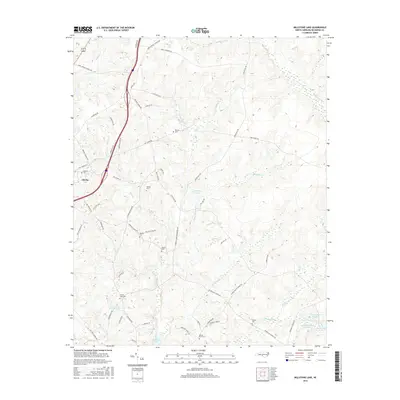
2016 Map of Millstone Lake
USGS Topo · Published 2016About this map
Ellerbe anchor the western edge of this Richmond County landscape, where the Sandhills terrain is defined by an intricate network of creeks and small impoundments. The geography here is dominated by water features like Millstone Lake, McKinney Lake, and Ledbetter Lake, which are fed by numerous tributaries such as Bones Fork, Naked Cr, and Hitchcock Cr. This area south of the Uwharries shows a transition from agricultural use to managed lands, notably marked by the Sandhill Game Management Rd and the Gibson Nursery Rd. For those researching local families, the map is dense with small burial sites including McLean Cem, Watson Cem, Rourks Cem, and Beaver Dam Cem. These small cemeteries and named roads like Jimmy Carriker Rd and O G Reynolds Rd reflect the deep-rooted rural community and family histories tied to this portion of the North Carolina interior.
Find a feature on this map
69 named features on this map. Tap any name to fly to it.
Don’t see what you’re looking for? This feature index may not catch every label — zoom into the map to look around manually.
Map Details
Editions of this 2016 Millstone Lake Map
This is the sole edition of this map. No revisions or reprints were ever made.
Other maps of this area

1942 · Troy
USGS Topo · 1:125,000

1942 · Rockingham
USGS Topo · 1:125,000

1949 · Millstone Lake
USGS Topo · 1:24,000

1949 · West End
USGS Topo · 1:24,000

1949 · Hoffman
USGS Topo · 1:24,000

1949 · Marston
USGS Topo · 1:24,000

1949 · Hamlet
USGS Topo · 1:24,000

1949 · Hamlet
USGS Topo · 1:62,500

1949 · Jackson Springs
USGS Topo · 1:62,500

1950 · Norman
USGS Topo · 1:24,000