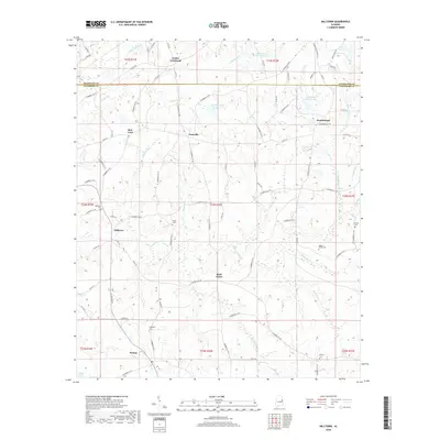
2018 Map of Milltown
USGS Topo · Published 2018About this map
Milltown and Penton anchor this landscape along the boundary of Randolph Co and Chambers Co in eastern Alabama. The area is characterized by a dense network of country roads and small, localized settlements like Clackville, Doublehead, and Rock Fence. The terrain is shaped by the winding course of Chikasanoxee Cr, which is joined by numerous tributaries including Whatley Cr, Mathews Br, and Carlisle Cr. For genealogists and local historians, the map provides precise locations for several family and community burial sites, such as Higgins Family Cem, Tatum Cem, and Sharps Cem. Larger water features like Smith and Norred Lake and Lake Louise appear near the northern border, while Edge Lake sits at the southwestern edge. The map reflects a predominantly rural, agricultural region where land ownership is still defined by township and range lines, such as t24n r26e, and movement is dictated by the creeks and ridges.
Find a feature on this map
96 named features on this map. Tap any name to fly to it.
Don’t see what you’re looking for? This feature index may not catch every label — zoom into the map to look around manually.
Map Details
Editions of this 2018 Milltown Map
This is the sole edition of this map. No revisions or reprints were ever made.
Other maps of this area

1891 · Ashland
USGS Topo · 1:125,000

1899 · Wedowee
USGS Topo · 1:125,000

1902 · Wedowee
USGS Topo · 1:125,000

1906 · Dadeville
USGS Topo · 1:125,000

1907 · Opelika
USGS Topo · 1:125,000

1909 · Opelika
USGS Topo · 1:125,000

1953 · Atlanta
USGS Topo · 1:250,000

1955 · Phenix City
USGS Topo · 1:250,000

1957 · Phenix City
USGS Topo · 1:250,000

1957 · Atlanta
USGS Topo · 1:250,000