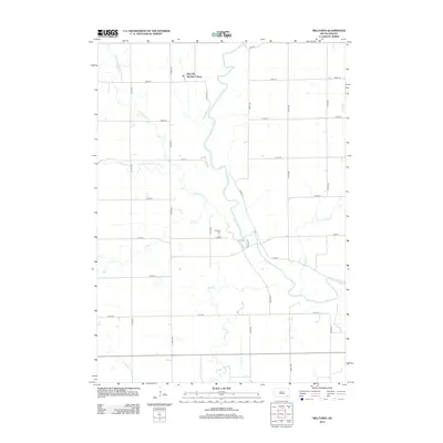
2012 Map of Milltown
USGS Topo · Published 2012About this map
The James River snakes through this rural landscape in Hutchinson County, forming a central corridor for a network of prairie tributaries. This 2012 survey illustrates the organized township structure of the region, defined by a rigid grid of section roads including 420th Ave and 273rd St. The New Elm Springs Colony stands as a primary settlement in the northern portion of the map, while the Milltown Cem serves as a significant local landmark near the river's bend. The hydrology of the area is exceptionally detailed, tracing the winding paths of Twelvemile Cr, Pony Cr, and Plum Cr as they drain toward the James. This document preserves the modern rural infrastructure of South Dakota, from the county routes like Co Rd-11 to the smaller family and farm roads that link these isolated prairie homesteads.
Find a feature on this map
25 named features on this map. Tap any name to fly to it.
Don’t see what you’re looking for? This feature index may not catch every label — zoom into the map to look around manually.
Map Details
Editions of this 2012 Milltown Map
This is the sole edition of this map. No revisions or reprints were ever made.
Other maps of this area

1898 · Olivet
USGS Topo · 1:125,000

1899 · Alexandria
USGS Topo · 1:125,000

1955 · Sioux Falls
USGS Topo · 1:250,000

1957 · Tschetter Colony
USGS Topo · 1:24,000

1957 · Ethan
USGS Topo · 1:24,000

1957 · Milltown
USGS Topo · 1:24,000

1957 · Clayton
USGS Topo · 1:24,000

1957 · Rockport Colony
USGS Topo · 1:24,000

1958 · Sioux Falls
USGS Topo · 1:250,000

1973 · Spencer SW
USGS Topo · 1:24,000
Featured Places
- Milltown, SD
- Clayton Township, SD
- Wittenberg Township, SD
- New Elm Spring Hutterite Colony, SD
- Worthen Township, SD