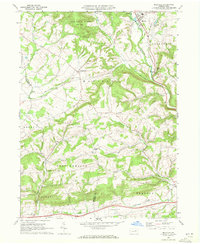
1968 Map of Millville
USGS Topo · Published 1972About this map
Millville serves as the primary hub in this Columbia County landscape, where the confluence of Little Fishing Creek and Spruce Run shaped the early settlement pattern. The late 1960s terrain is characterized by a mix of agricultural valleys and wooded uplands, including the expansive State Game Lands No 226 in the north. The presence of the Penn Central railroad corridors winding through the valleys of Mud Creek and Hemlock Creek reflects the region's historical reliance on rail for transporting local timber and agricultural goods.
Find a feature on this map
35 named features on this map. Tap any name to fly to it.
Don’t see what you’re looking for? This feature index may not catch every label — zoom into the map to look around manually.
Map Details
Editions of this 1968 Millville Map
3 editions found
Other maps of this area

1889 · Catawissa
USGS Topo · 1:62,500

1892 · Catawissa
USGS Topo · 1:62,500

1892 · Shamokin
USGS Topo · 1:62,500

1893 · Shamokin
USGS Topo · 1:62,500

1894 · Catawissa
USGS Topo · 1:62,500

1894 · Bloomsburg
USGS Topo · 1:62,500

1935 · Hughesville
USGS Topo · 1:62,500

1943 · Shamokin
USGS Topo · 1:62,500

1947 · Bloomsburg
USGS Topo · 1:24,000
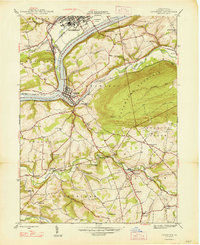
1947 · Catawissa
USGS Topo · 1:24,000
Featured Places
- Greenwood Township, PA
- Millville, PA
- Pine Township, PA
- East Millville, PA
- Eyers Grove, Greenwood Township