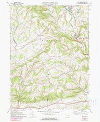
1968 Map of Millville
USGS Topo · Published 1990About this map
Little Fishing Creek meanders through the northeast corner of this quadrangle, anchoring the borough of Millville and the nearby village of Eyers Grove. The landscape is a patchwork of ridges and valley runs spanning the border of Columbia and Montour counties. To the west, Jerseytown sits at a prominent crossroads, while the Conrail rail line tracks through the valley floor toward Derry.
Find a feature on this map
39 named features on this map. Tap any name to fly to it.
Don’t see what you’re looking for? This feature index may not catch every label — zoom into the map to look around manually.
Map Details
Editions of this 1968 Millville Map
3 editions found
Other maps of this area

1889 · Catawissa
USGS Topo · 1:62,500

1892 · Catawissa
USGS Topo · 1:62,500

1892 · Shamokin
USGS Topo · 1:62,500

1893 · Shamokin
USGS Topo · 1:62,500

1894 · Catawissa
USGS Topo · 1:62,500

1894 · Bloomsburg
USGS Topo · 1:62,500

1935 · Hughesville
USGS Topo · 1:62,500

1943 · Shamokin
USGS Topo · 1:62,500

1947 · Bloomsburg
USGS Topo · 1:24,000
1947 · Catawissa
USGS Topo · 1:24,000
Featured Places
- Greenwood Township, PA
- Millville, PA
- Pine Township, PA
- East Millville, PA
- Eyers Grove, Greenwood Township