Loading...
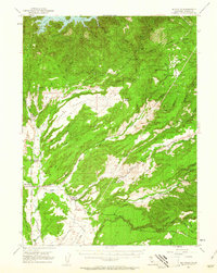
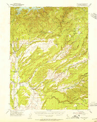
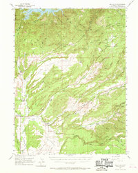
Loading map...1953 Map of Millville
USGS Topo · Published 1961About this map
Millville and the surrounding Shasta County terrain are defined by the intricate hydrology of Little Cow Creek and Clover Creek in the early 1950s. The landscape is a transition between the Stillwater Plains and the rising timberlands, marked by infrastructure like the Cow Creek Powerhouse and the Millville Ditch. This era shows a community still deeply tied to its rural roots, evidenced by the clustered Masonic Cem and Odd Fellows Cem near the town center.
Find a feature on this map
53 named features on this map. Tap any name to fly to it.
Don’t see what you’re looking for? This feature index may not catch every label — zoom into the map to look around manually.
Map Details
Date Portrayed1953
Date Published1961
PublisherU.S. Geological Survey
Map TypeTopographic
Scale1:62,500
Physical Dimensions16.6 x 20.9 inches
Editions of this 1953 Millville Map
3 editions found
Historical Maps of Millville Through Time
1 maps found
Featured Locations
Source Details
SourceU.S. Geological Survey
CopyrightPublic Domain