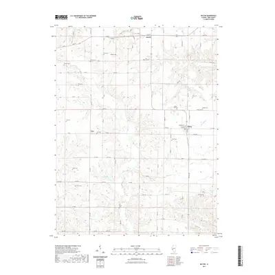
2021 Map of Milton
USGS Topo · Published 2021About this map
The village of Milton and the crossroads of Time anchor this portion of Pike County, characterized by a complex network of family burial grounds and winding creeks. This modern topographic record emphasizes a rural landscape where history is preserved in names like Cox Family Cem, Milton-Smith Cem, and Pettis Cem. The terrain is defined by the drainage of Bay Cr, Little Blue Cr, and Moose Cr, which carve through the land near landmarks such as Calvert Hill. In the northern section, the settlement of Detroit sits near the intersection of several county routes, illustrating the enduring agricultural infrastructure of the Illinois interior. For researchers, the density of small cemeteries like Thurman Cem and Watts Cem suggests a long-standing pattern of localized family settlement across the ridges and valleys.
Find a feature on this map
93 named features on this map. Tap any name to fly to it.
Don’t see what you’re looking for? This feature index may not catch every label — zoom into the map to look around manually.
Map Details
Editions of this 2021 Milton Map
This is the sole edition of this map. No revisions or reprints were ever made.
Other maps of this area

1924 · Griggsville
USGS Topo · 1:62,500

1926 · Griggsville
USGS Topo · 1:62,500

1926 · Pittsfield
USGS Topo · 1:62,500

1930 · Pearl
USGS Topo · 1:62,500

1930 · Nebo
USGS Topo · 1:62,500

1934 · Nebo
USGS Topo · 1:48,000

1942 · Nebo
USGS Topo · 1:62,500

1948 · Quincy
USGS Topo · 1:250,000

1950 · Pearl
USGS Topo · 1:62,500

1956 · Quincy
USGS Topo · 1:250,000