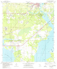
1978 Map of Milton South
USGS Topo · Published 1978About this map
The Blackwater River and Escambia Bay define the geography of this mid-1970s survey, where the historic milling and shipping hub of Bagdad sits near the river's mouth. The town of Milton anchors the northern section, featuring the Pensacola Jr College (Milton Center) and Jackson Sch, while the grid-like residential expansion of Avalon Beach stretches toward the waters of Blackwater Bay. Industrial activity is evident in the numerous sandpits dotting the landscape, particularly around Galt City and Pea Ridge. Historical researchers can trace local lineage through several dedicated burial grounds, including Strickland Cem and Magnolia Cem. The corridor of the Louisville and Nashville railroad tracks through the region, connecting smaller settlements like Mulat and providing a glimpse into the late 20th-century transportation network of the Florida Panhandle.
Find a feature on this map
63 named features on this map. Tap any name to fly to it.
Don’t see what you’re looking for? This feature index may not catch every label — zoom into the map to look around manually.
Map Details
Editions of this 1978 Milton South Map
2 editions found
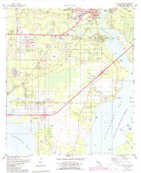
Other maps of this area

1920 · Milton
USGS Topo · 1:62,500

1921 · Holley
USGS Topo · 1:62,500

1921 · Pensacola
USGS Topo · 1:62,500

1934 · Harold
USGS Topo · 1:62,500

1936 · Holley
USGS Topo · 1:48,000

1937 · Harold
USGS Topo · 1:62,500

1938 · Holley
USGS Topo · 1:62,500

1938 · Harold
USGS Topo · 1:62,500

1941 · Pensacola
USGS Topo · 1:62,500

1941 · Milton
USGS Topo · 1:62,500