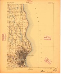
1892 Map of Milwaukee
USGS Topo · Published 1897About this map
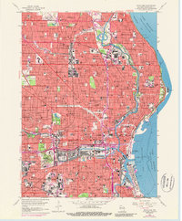
Milwaukee's urban grid and industrial waterfront dominate this late nineteenth-century landscape, as recorded by the U.S. Geological Survey under Director J.W. Powell. The city is shown as a dense hub of transport, where the Milwaukee River and Menomonee River converge before meeting the expansive shoreline of Lake Michigan. Outside the central city core, the map reveals a transition into the more rural townships of Wauwatosa and Granville, characterized by a sparse network of roads and the emerging village of Whitefish Bay.
Find a feature on this map
22 named features on this map. Tap any name to fly to it.
Don’t see what you’re looking for? This feature index may not catch every label — zoom into the map to look around manually.
Map Details
Editions of this 1892 Milwaukee Map
2 editions found

Historical Maps of Milwaukee Through Time
9 maps found
1892 Milwaukee
Milwaukee County, WI

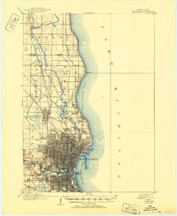
1901 Milwaukee
Milwaukee County, WI
1906 Milwaukee
Milwaukee County, WI
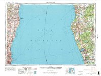
1954 Milwaukee
Milwaukee County, WI

1958 Milwaukee
Milwaukee County, WI
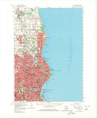
1958 Milwaukee
Milwaukee County, WI
1958 Milwaukee
Milwaukee County, WI
1980 Milwaukee
Milwaukee County, WI

2022 Milwaukee
Milwaukee County, WI