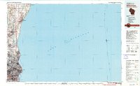
1980 Map of Milwaukee
USGS Topo · Published 1981About this map
Lake Michigan dominates this coastal survey, where the urban expansion of Milwaukee meets the developed shoreline of Ozaukee County in the early 1980s. The map illustrates the industrial and residential density of Wauwatosa and West Allis as it contrasts with the smaller northern settlements like Port Washington and Cedarburg. Educational landmarks such as the University of Wisconsin at Milwaukee and Milwaukee-Downer College are clearly situated near the lakefront, while transportation is defined by the Chicago and North Western rail lines and small aviation sites like Ozaukee Landing Field.
Find a feature on this map
47 named features on this map. Tap any name to fly to it.
Don’t see what you’re looking for? This feature index may not catch every label — zoom into the map to look around manually.
Map Details
Editions of this 1980 Milwaukee Map
This is the sole edition of this map. No revisions or reprints were ever made.
Other maps of this area

1891 · Bayview
USGS Topo · 1:62,500

1891 · Muskego
USGS Topo · 1:62,500

1892 · Milwaukee
USGS Topo · 1:62,500

1892 · Waukesha
USGS Topo · 1:62,500

1892 · Port Washington
USGS Topo · 1:62,500

1901 · Milwaukee
USGS Topo · 1:62,500

1901 · Waukesha
USGS Topo · 1:62,500

1901 · Bayview
USGS Topo · 1:62,500

1901 · Muskego
USGS Topo · 1:62,500

1904 · West Bend
USGS Topo · 1:62,500