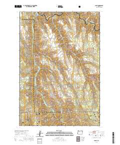
2020 Map of Minam
USGS Topo · Published 2020About this map
Minam sits at the confluence of the Wallowa River and Minam River, serving as a gateway to the high-elevation canyonlands of the Pacific Northwest. This recent survey highlights the complex administrative landscape where the Wallowa National Forest and Whitman National Forest converge. Along the upper reaches of the drainage, the Irrigon Fish Hatchery represents a significant investment in regional river ecology and management. The map details the protected status of these waterways through designations like the Wallowa Wild and Scenic River and the Minam Wild and Scenic River. Topographic features such as Meads Flat, Cougar Ridge, and High Ridge define the steep elevation changes characteristic of this portion of the Union and Wallowa County border. Remote landmarks like Division Camp and numerous named springs, including Chestnut Spring, offer touchpoints for backcountry researchers and local historians.
Find a feature on this map
30 named features on this map. Tap any name to fly to it.
Don’t see what you’re looking for? This feature index may not catch every label — zoom into the map to look around manually.
Map Details
Editions of this 2020 Minam Map
This is the sole edition of this map. No revisions or reprints were ever made.
Other maps of this area

1906 · Telocaset
USGS Topo · 1:125,000

1955 · Grangeville
USGS Topo · 1:250,000

1959 · Grangeville
USGS Topo · 1:250,000

1964 · Howard Butte
USGS Topo · 1:24,000

1964 · Akers Butte
USGS Topo · 1:24,000

1964 · Cricket Flat
USGS Topo · 1:24,000

1964 · Wallowa
USGS Topo · 1:24,000

1964 · Minam
USGS Topo · 1:24,000

1964 · Rondowa
USGS Topo · 1:24,000

1965 · Fox Point
USGS Topo · 1:24,000