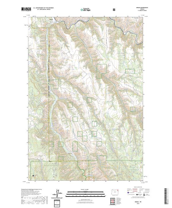
2023 Map of Minam
USGS Topo · Published 2023About this map
The small community of Minam sits at the confluence of the Wallowa River and the Minam River, serving as a critical gateway to the protected landscapes of Northeastern Oregon. This 2023 survey illustrates a region defined by its conservation status, where the Wallowa-Wild and Scenic River and Minam Wild and Scenic River corridors slice through a complex topography of ridges and flats. Much of the southern terrain is dominated by the Eagle Cap Wilderness, bordered by the expansive reaches of the Whitman National Forest and Wallowa National Forest. Beyond the wild lands, the Irrigon Fish Hatchery is located north of the Minam settlement. Local landmarks such as Smith Mtn, Meads Flat, and Cougar Ridge provide reference points across the steep drainages of Big Canyon and Skylight Canyon, documenting the area's natural heritage and management boundaries.
Find a feature on this map
32 named features on this map. Tap any name to fly to it.
Don’t see what you’re looking for? This feature index may not catch every label — zoom into the map to look around manually.
Map Details
Editions of this 2023 Minam Map
This is the sole edition of this map. No revisions or reprints were ever made.
Other maps of this area

1906 · Telocaset
USGS Topo · 1:125,000

1955 · Grangeville
USGS Topo · 1:250,000

1959 · Grangeville
USGS Topo · 1:250,000

1964 · Howard Butte
USGS Topo · 1:24,000

1964 · Akers Butte
USGS Topo · 1:24,000

1964 · Cricket Flat
USGS Topo · 1:24,000

1964 · Wallowa
USGS Topo · 1:24,000

1964 · Minam
USGS Topo · 1:24,000

1964 · Rondowa
USGS Topo · 1:24,000

1965 · Fox Point
USGS Topo · 1:24,000