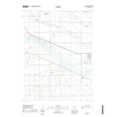
2017 Map of Minatare
USGS Topo · Published 2017About this map
Minatare and the neighboring settlement of Melbeta sit within a highly engineered hydraulic landscape along the North Platte River. This 2017 survey details the complex network of irrigation and drainage infrastructure critical to Scotts Bluff County agriculture, featuring the Winters Cr Canal, Minatare Canal, Castle Rock Canal, and the Fort Laramie Canal. The presence of the East Gering Drain Reservoir and the Fairfield Seep illustrates the management of water levels across the Gering Valley. To the north, the Western Nebraska Regional Airport and the community of Hillerage mark the transition from the river bottom to the higher plains, where the East Lawn Cem serves the local population.
Find a feature on this map
46 named features on this map. Tap any name to fly to it.
Don’t see what you’re looking for? This feature index may not catch every label — zoom into the map to look around manually.
Map Details
Editions of this 2017 Minatare Map
This is the sole edition of this map. No revisions or reprints were ever made.
Other maps of this area

1898 · Scotts Bluff
USGS Topo · 1:125,000

1898 · Camp Clarke
USGS Topo · 1:125,000

1954 · Scottsbluff
USGS Topo · 1:250,000

1958 · Scottsbluff
USGS Topo · 1:250,000

1963 · Scottsbluff South
USGS Topo · 1:24,000

1963 · Scottsbluff North
USGS Topo · 1:24,000

1965 · Minatare
USGS Topo · 1:24,000
1965 · Lake Alice
USGS Topo · 1:24,000

1965 · Bayard SW
USGS Topo · 1:24,000

1965 · McGrew
USGS Topo · 1:24,000