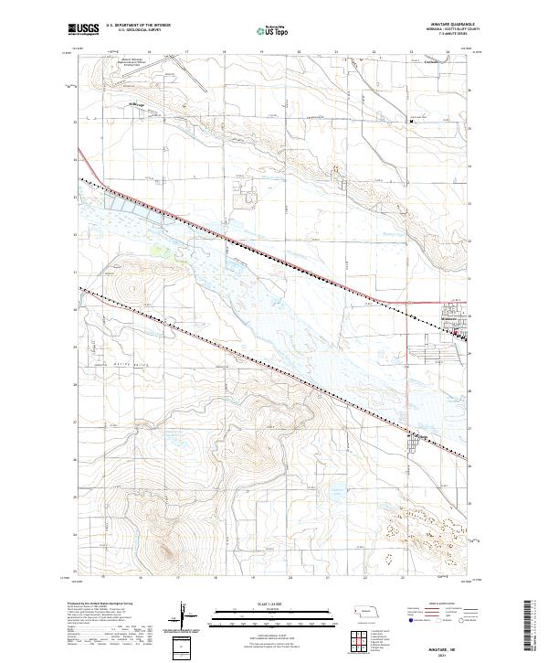
2021 Map of Minatare
USGS Topo · Published 2021About this map
The North Platte River serves as the dominant geographical feature of this Western Nebraska landscape, dividing the fertile valley into a complex network of irrigation infrastructure. This 2021 survey illustrates the intricate water management system essential to the region, featuring the Minatare Canal, Gering Canal, and Fort Laramie Canal, alongside numerous drains and seeps like the Fairfield Seep. These man-made waterways support the agricultural character of Gering Valley, providing a detailed look at how the high plains have been transformed for cultivation.
Find a feature on this map
44 named features on this map. Tap any name to fly to it.
Don’t see what you’re looking for? This feature index may not catch every label — zoom into the map to look around manually.
Map Details
Editions of this 2021 Minatare Map
This is the sole edition of this map. No revisions or reprints were ever made.
Other maps of this area

1898 · Scotts Bluff
USGS Topo · 1:125,000

1898 · Camp Clarke
USGS Topo · 1:125,000

1954 · Scottsbluff
USGS Topo · 1:250,000

1958 · Scottsbluff
USGS Topo · 1:250,000

1963 · Scottsbluff South
USGS Topo · 1:24,000

1963 · Scottsbluff North
USGS Topo · 1:24,000

1965 · Minatare
USGS Topo · 1:24,000
1965 · Lake Alice
USGS Topo · 1:24,000

1965 · Bayard SW
USGS Topo · 1:24,000

1965 · McGrew
USGS Topo · 1:24,000