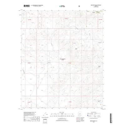
2018 Map of Mine Mountain
USGS Topo · Published 2018About this map
Tonto National Forest defines the rugged character of this Maricopa County interior, where the Mazatzal Mountains rise sharply against the horizon. The landscape is marked by a complex network of canyons and washes, including the prominent Mesquite Wash and Cane Spring Canyon, which trace the drainage patterns of the arid high desert. This 2018 survey reveals a terrain defined by named water sources and geological landmarks, such as Mine Mountain Spring and the Malpais Cliffs. Human presence is sparse, confined primarily to unpaved access routes like Cline Cabin Rd and Svr Rd 143. The map documents a wilderness still largely shaped by its natural hydrology and relief, from the heights of Pine Mtn down to the seasonal flows of Picadilla Cr and Cottonwood Cr.
Find a feature on this map
46 named features on this map. Tap any name to fly to it.
Don’t see what you’re looking for? This feature index may not catch every label — zoom into the map to look around manually.
Map Details
Editions of this 2018 Mine Mountain Map
This is the sole edition of this map. No revisions or reprints were ever made.
Other maps of this area

1904 · Ft. McDowell
USGS Topo · 1:62,500

1906 · Ft. McDowell
USGS Topo · 1:62,500

1907 · Roosevelt
USGS Topo · 1:125,000

1909 · Four Peaks
USGS Topo · 1:125,000

1912 · Roosevelt
USGS Topo · 1:125,000

1930 · Cave Creek
USGS Topo · 1:125,000

1939 · Cave Creek
USGS Topo · 1:125,000

1954 · Mesa
USGS Topo · 1:250,000

1957 · Mesa
USGS Topo · 1:250,000

1958 · Mesa
USGS Topo · 1:250,000