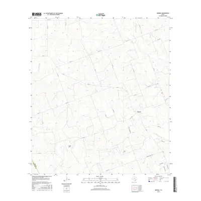
2016 Map of Mineral
USGS Topo · Published 2016About this map
Mineral stands as the primary settlement in this corner of Bee County, where the landscape is defined by a dendritic network of intermittent drainage ways. The community is linked to the surrounding countryside via a web of Farm to Market roads, including FM 623 W and FM 673. Local genealogy is anchored at the Mineral Cem, located south of the main townsite along Mineral Cemetery Rd. The terrain is shaped by the winding courses of Toro Cr and San Domingo Cr, while more localized features like Vatoss Gully and Salt Br highlight the intricate local hydrology. Residential developments on the southern edge of the map, such as those along Chuckar Dr and Bob White Trl, illustrate more recent land use patterns contrasting with the older rural routes like The Lane.
Find a feature on this map
33 named features on this map. Tap any name to fly to it.
Don’t see what you’re looking for? This feature index may not catch every label — zoom into the map to look around manually.
Map Details
Editions of this 2016 Mineral Map
This is the sole edition of this map. No revisions or reprints were ever made.
Other maps of this area

1920 · Mikeska
USGS Topo · 1:125,000

1927 · Oakville
USGS Topo · 1:62,500

1936 · Pettus
USGS Topo · 1:62,500

1953 · Crystal City
USGS Topo · 1:250,000

1953 · Beeville
USGS Topo · 1:250,000

1954 · Fleming
USGS Topo · 1:62,500

1955 · Crystal City
USGS Topo · 1:250,000

1956 · Suniland
USGS Topo · 1:62,500

1956 · Beeville
USGS Topo · 1:250,000

1956 · Pettus
USGS Topo · 1:62,500