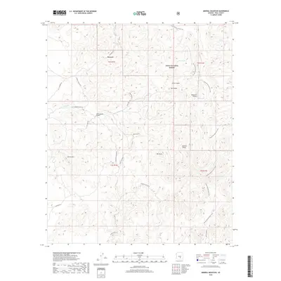
2018 Map of Mineral Mountain
USGS Topo · Published 2018About this map
Reymert stands as a focal point in this high-desert landscape, situated along N Reymert Rd near the northern boundary of the Tonto National Forest. This 2018 survey reveals a terrain defined by complex drainage systems and prominent landmarks like Mineral Mtn and Bell Butte. The map documents a network of primitive roads and trails that speak to the area's mining and ranching heritage, including the Ajax Mine Trl and Red Mt Mine Rd. Water sources remain critical in this arid environment, marked by sites such as Filaria Spring, Trough Springs, and Seep Spring. Significant geological features such as Cottonwood Canyon and the deep cuts of Box Canyon dominate the central topography, while the Arizona National Scenic Trail winds through the eastern ridges, providing a modern recreational layer to a landscape historically shaped by extraction and livestock.
Find a feature on this map
31 named features on this map. Tap any name to fly to it.
Don’t see what you’re looking for? This feature index may not catch every label — zoom into the map to look around manually.
Map Details
Editions of this 2018 Mineral Mountain Map
This is the sole edition of this map. No revisions or reprints were ever made.
Other maps of this area

1900 · Florence
USGS Topo · 1:125,000

1902 · Florence
USGS Topo · 1:125,000

1948 · Superior
USGS Topo · 1:62,500

1948 · Superior
USGS Topo · 1:24,000

1948 · Picketpost Mtn
USGS Topo · 1:24,000

1949 · Superior
USGS Topo · 1:24,000

1949 · Picketpost Mtn
USGS Topo · 1:24,000

1954 · Mesa
USGS Topo · 1:250,000

1957 · Mesa
USGS Topo · 1:250,000

1958 · Mesa
USGS Topo · 1:250,000