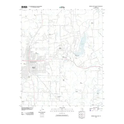
2010 Map of Mineral Wells East
USGS Topo · Published 2010About this map
Mineral Wells anchors this 2010 landscape, where the eastern reaches of the city meet the recreation-heavy waters of Lake Mineral Wells. The urban core is defined by its topographic diversity, specifically between West Mountain and East Mountain, while the transportation history of the region is preserved at the Weatherford-Mineral Wells and Northwestern Railroad Depot. The map reveals a transition from the city's structured streets to the rural surroundings of Sturdivant and Millsap to the south.
Find a feature on this map
76 named features on this map. Tap any name to fly to it.
Don’t see what you’re looking for? This feature index may not catch every label — zoom into the map to look around manually.
Map Details
Editions of this 2010 Mineral Wells East Map
This is the sole edition of this map. No revisions or reprints were ever made.
Other maps of this area

1891 · Weatherford
USGS Topo · 1:125,000

1891 · Palo Pinto
USGS Topo · 1:125,000

1893 · Weatherford
USGS Topo · 1:125,000

1918 · Palo Pinto
USGS Topo · 1:125,000

1924 · Palo Pinto 1-b
USGS Topo · 1:48,000

1925 · Palo Pinto 4-b
USGS Topo · 1:48,000

1927 · Mineral Wells
USGS Topo · 1:62,500

1931 · Dennis
USGS Topo · 1:62,500

1931 · Santo
USGS Topo · 1:62,500

1954 · Dallas
USGS Topo · 1:250,000