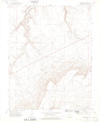
1972 Map of Miners Peak
USGS Topo · Published 1975About this map
Santa Fe Trail and Fort Union Road cut through this southeastern Colorado landscape, marking a legacy of western passage and transit. The high ground is dominated by Miners Peak, while the carved drainages of Chacuaco Canyon and Tobe Canyon dictate the natural movement of water and livestock. Significant to local history are the remote markers of human presence, including a Cem and a Prospect located near the peak. Water remains a critical resource in this arid terrain, anchored by Aguaje Springs and the flow of Chacuaco Creek. The deep incision of Salazar Rincon further defines the complex topography, showing how early roads and trails navigated the breaks and mesas of Las Animas County during the early 1970s.
Find a feature on this map
14 named features on this map. Tap any name to fly to it.
Don’t see what you’re looking for? This feature index may not catch every label — zoom into the map to look around manually.
Map Details
Editions of this 1972 Miners Peak Map
2 editions found
Other maps of this area

1891 · Mesa De Maya
USGS Topo · 1:125,000

1893 · Mesa de Maya
USGS Topo · 1:125,000

1955 · La Junta
USGS Topo · 1:250,000

1958 · La Junta
USGS Topo · 1:250,000

1968 · La Junta
USGS Topo · 1:250,000
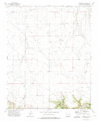
1972 · Branson SE
USGS Topo · 1:24,000
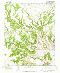
1972 · Cobert Mesa North
USGS Topo · 1:24,000

1972 · Miners Peak
USGS Topo · 1:24,000

1972 · Tobe
USGS Topo · 1:24,000

1972 · Doss Canyon South
USGS Topo · 1:24,000