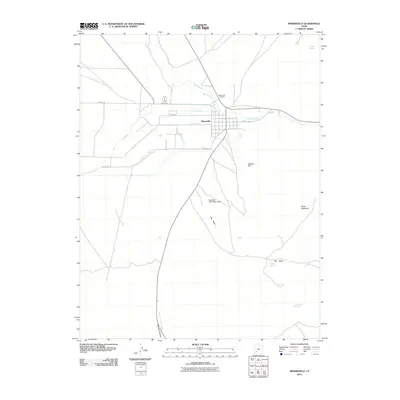
2011 Map of Minersville
USGS Topo · Published 2011About this map
Minersville serves as the focal point of this southwestern Utah survey, situated at a junction where the waters of the Beaver River are carefully managed through an extensive network of irrigation infrastructure. The map reveals the intricate water rights and engineering of the region, featuring named channels such as the Utopia Ditch, The Mile Ditch, and the Minersville Canal. These waterways snake across the flats beneath the prominence of Muddy Hill and Black Mountain. To the north of the town center, the Minersville Cemetery provides a specific point of interest for genealogists tracing early families. Southward, the landscape transitions toward the high desert drainages of Parowan Canyon and Big Wash, where the Big Wash Debris Basin Dam stands as a guard against flash flooding in this arid climate.
Find a feature on this map
24 named features on this map. Tap any name to fly to it.
Don’t see what you’re looking for? This feature index may not catch every label — zoom into the map to look around manually.
Map Details
Editions of this 2011 Minersville Map
This is the sole edition of this map. No revisions or reprints were ever made.
Other maps of this area

1885 · Beaver
USGS Topo · 1:250,000

1953 · Ninemile Knoll
USGS Topo · 1:24,000

1953 · Milford Flat
USGS Topo · 1:24,000

1953 · Minersville
USGS Topo · 1:24,000

1953 · Cave Canyon
USGS Topo · 1:24,000

1953 · Richfield
USGS Topo · 1:250,000

1958 · Richfield
USGS Topo · 1:250,000

1958 · Minersville
USGS Topo · 1:62,500

1958 · Thermo
USGS Topo · 1:62,500

1958 · Milford
USGS Topo · 1:62,500