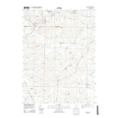
2013 Map of Minerva
USGS Topo · Published 2013About this map
Minerva serves as a central hub where the borders of Stark, Carroll, and Columbiana counties meet. This modern survey illustrates a landscape defined by the branching waters of the Still Fork and Muddy Fork, which carve through the terrain near settlements like East Rochester and Bayard. The mapping of township lines and section numbers provides a clear framework for identifying property locations and land use patterns throughout the region.
Find a feature on this map
82 named features on this map. Tap any name to fly to it.
Don’t see what you’re looking for? This feature index may not catch every label — zoom into the map to look around manually.
Map Details
Editions of this 2013 Minerva Map
This is the sole edition of this map. No revisions or reprints were ever made.
Other maps of this area

1905 · Salineville
USGS Topo · 1:62,500

1909 · Alliance
USGS Topo · 1:62,500

1909 · Lisbon
USGS Topo · 1:62,500

1910 · Carrollton
USGS Topo · 1:62,500

1912 · Carrollton
USGS Topo · 1:62,500

1951 · Canton
USGS Topo · 1:250,000

1953 · Canton
USGS Topo · 1:250,000

1957 · Canton
USGS Topo · 1:250,000
1959 · Dellroy
USGS Topo · 1:24,000
1959 · Hanoverton
USGS Topo · 1:24,000