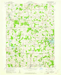
1959 Map of Hanoverton
USGS Topo · Published 1961About this map
Hanoverton sits at the southern edge of this Columbiana County landscape, where the agricultural plateaus of Hanover and West townships meet the waters of Sandy Creek. In the late 1950s, the region maintained a dense network of small crossroads communities including New Garden, North Georgetown, and Winona. The presence of United Schools and various family-named burial grounds like King Cem and Dutton Cem speaks to a well-established rural social fabric.
Find a feature on this map
57 named features on this map. Tap any name to fly to it.
Don’t see what you’re looking for? This feature index may not catch every label — zoom into the map to look around manually.
Map Details
Editions of this 1959 Hanoverton Map
2 editions found
Other maps of this area

1905 · Salineville
USGS Topo · 1:62,500

1909 · Alliance
USGS Topo · 1:62,500

1909 · Lisbon
USGS Topo · 1:62,500

1910 · Carrollton
USGS Topo · 1:62,500

1912 · Carrollton
USGS Topo · 1:62,500

1951 · Canton
USGS Topo · 1:250,000

1952 · Alliance
USGS Topo · 1:24,000

1952 · Damascus
USGS Topo · 1:24,000
1952 · Salem
USGS Topo · 1:24,000

1953 · Canton
USGS Topo · 1:250,000