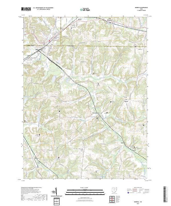
2023 Map of Minerva
USGS Topo · Published 2023About this map
Minerva serves as the focal point of this region where Stark, Carroll, and Columbiana counties converge. The village is surrounded by a network of rural hamlets including Pattersonville, Bayard, and East Rochester. The landscape is defined by the winding course of the Still Fork and its many tributaries like Wholebark Run and Pumpkin Run, which carve through the Shenandoah Valley. A high concentration of family and community burial grounds, such as Plaines Cem, Chestnut Knob Cem, and Herrington Bethel Cem, suggests a long history of local settlement and genealogical continuity. Aviation interest is noted at Parsons Airport and Hibbetts Airport, while the southern reaches of the map show the transition into more deeply dissected terrain near Specht and Watheys. This map provides a clear picture of how transportation routes like Kensington Rd NE and Canton Rd NW have historically linked these dispersed agricultural communities.
Find a feature on this map
96 named features on this map. Tap any name to fly to it.
Don’t see what you’re looking for? This feature index may not catch every label — zoom into the map to look around manually.
Map Details
Editions of this 2023 Minerva Map
This is the sole edition of this map. No revisions or reprints were ever made.
Other maps of this area

1905 · Salineville
USGS Topo · 1:62,500

1909 · Alliance
USGS Topo · 1:62,500

1909 · Lisbon
USGS Topo · 1:62,500

1910 · Carrollton
USGS Topo · 1:62,500

1912 · Carrollton
USGS Topo · 1:62,500

1951 · Canton
USGS Topo · 1:250,000

1953 · Canton
USGS Topo · 1:250,000

1957 · Canton
USGS Topo · 1:250,000
1959 · Dellroy
USGS Topo · 1:24,000
1959 · Hanoverton
USGS Topo · 1:24,000