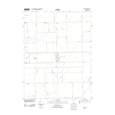
2012 Map of Minier
USGS Topo · Published 2012About this map
Minier serves as the primary hub in this central Illinois landscape, where the grid of rural township roads intersects with several historic local settlements. Small communities like Mindale, Walnut, and Tazewell anchor the surrounding agricultural tracts, while the Illinois Valley Parachute Club Airport provides a distinct aviation landmark west of the main town center. The drainage patterns of the Little Mackinaw River and the W Fork Sugar Cr reveal the natural topography that dictated early property lines and road placements, such as Townline Rd and Mackinaw Rd. Genealogists will find several well-preserved burial grounds, including Greenwood Cem, Gaines Cem, and Camp Cem, which offer significant research value for tracing family lineages in the region. The map captures the area before modern expansion, preserving the locations of rural crossroads like Fravert and Sutter.
Find a feature on this map
65 named features on this map. Tap any name to fly to it.
Don’t see what you’re looking for? This feature index may not catch every label — zoom into the map to look around manually.
Map Details
Editions of this 2012 Minier Map
This is the sole edition of this map. No revisions or reprints were ever made.
Other maps of this area

1927 · Danvers
USGS Topo · 1:62,500

1928 · Mackinaw
USGS Topo · 1:62,500

1930 · Danvers
USGS Topo · 1:62,500

1932 · Mackinaw
USGS Topo · 1:62,500

1949 · Mc Lean
USGS Topo · 1:62,500

1951 · McLean
USGS Topo · 1:62,500

1951 · Minier
USGS Topo · 1:62,500

1958 · Peoria
USGS Topo · 1:250,000

1961 · Peoria
USGS Topo · 1:250,000

1963 · Peoria
USGS Topo · 1:250,000