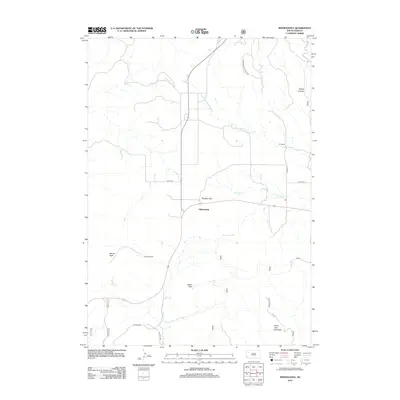
2012 Map of Minnekahta
USGS Topo · Published 2012About this map
Minnekahta occupies a central position within this high-plains landscape, where the confluence of several transportation corridors meets the varied topography of southwestern South Dakota. The area is defined by significant vertical relief, ranging from the prominent Parker Peak and Matias Peak in the west to the southern reaches of Horse Trap Mountain. Drainages such as Hot Brook and Cottonwood Springs Cr carve through the terrain, creating named features like Argyle Canyon and Falls Canyon. The settlement pattern is characterized by established ranching operations, including the Z R Ranch and Johnson Ranch, which are linked by a network of county highways. This document captures the modern state of land use in the region, illustrating the relationship between the broad open space of Bradley Flats and the more restrictive, narrow corridors of the surrounding canyons.
Find a feature on this map
18 named features on this map. Tap any name to fly to it.
Don’t see what you’re looking for? This feature index may not catch every label — zoom into the map to look around manually.
Map Details
Editions of this 2012 Minnekahta Map
This is the sole edition of this map. No revisions or reprints were ever made.
Other maps of this area

1896 · Harney Peak
USGS Topo · 1:125,000

1901 · Harney Peak
USGS Topo · 1:125,000

1902 · Edgemont
USGS Topo · 1:125,000

1950 · Edgemont
USGS Topo · 1:24,000

1950 · Cascade Springs
USGS Topo · 1:24,000

1950 · Edgemont NE
USGS Topo · 1:24,000

1950 · Minnekahta
USGS Topo · 1:24,000

1950 · Flint Hill
USGS Topo · 1:24,000

1951 · Minnekahta NE
USGS Topo · 1:24,000

1954 · Jewel Cave SE
USGS Topo · 1:24,000