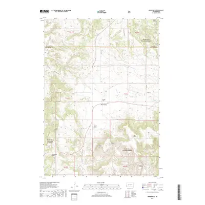
2017 Map of Minnekahta
USGS Topo · Published 2017About this map
Minnekahta sits at a crossroads of the southern Black Hills, where modern routes like Wild Sage Rd and Old Hwy 18 intersect against a backdrop of complex canyon systems and high peaks. This landscape, dominated by the Black Hills National Forest, is defined by its dramatic relief, moving from the open expanse of Bradley Flats to the narrow corridors of Hell Canyon and Falls Canyon.
Find a feature on this map
29 named features on this map. Tap any name to fly to it.
Don’t see what you’re looking for? This feature index may not catch every label — zoom into the map to look around manually.
Map Details
Editions of this 2017 Minnekahta Map
This is the sole edition of this map. No revisions or reprints were ever made.
Other maps of this area

1896 · Harney Peak
USGS Topo · 1:125,000

1901 · Harney Peak
USGS Topo · 1:125,000

1902 · Edgemont
USGS Topo · 1:125,000

1950 · Edgemont
USGS Topo · 1:24,000

1950 · Cascade Springs
USGS Topo · 1:24,000

1950 · Edgemont NE
USGS Topo · 1:24,000

1950 · Minnekahta
USGS Topo · 1:24,000

1950 · Flint Hill
USGS Topo · 1:24,000

1951 · Minnekahta NE
USGS Topo · 1:24,000

1954 · Jewel Cave SE
USGS Topo · 1:24,000