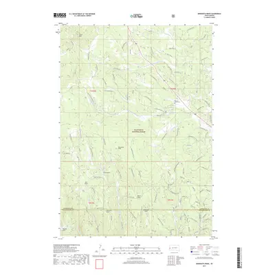
2017 Map of Minnesota Ridge
USGS Topo · Published 2017About this map
Black Hills National Forest land dominates this high-altitude landscape in western South Dakota, centered on the prominent spine of Minnesota Ridge. The area is characterized by a complex network of drainages and named gulches, including Greens Gulch, Benner Gulch, and Moonshine Gulch, which feed into the forks of N Boxelder Cr and Silver Creek. Cultural landmarks are sparse in this timbered terrain, but include the isolated Mountain Meadow Cem and the recreational waters of Roubaix Lake. In the northern section, Custer Peak stands as a significant topographic waypoint. The map reveals an extensive system of forest roads and trails, such as Paha Sapa Br 1E and Custer Crossing Rd, illustrating the intersection of modern resource management and early twentieth-century travel routes through the Pennington and Lawrence County lines.
Find a feature on this map
107 named features on this map. Tap any name to fly to it.
Don’t see what you’re looking for? This feature index may not catch every label — zoom into the map to look around manually.
Map Details
Editions of this 2017 Minnesota Ridge Map
This is the sole edition of this map. No revisions or reprints were ever made.
Other maps of this area

1894 · Deadwood
USGS Topo · 1:125,000

1899 · Sturgis
USGS Topo · 1:62,500

1900 · Spearfish
USGS Topo · 1:62,500

1901 · Deadwood
USGS Topo · 1:125,000

1915 · Spearfish
USGS Topo · 1:62,500

1915 · Sturgis
USGS Topo · 1:62,500

1916 · Deadwood
USGS Topo · 1:125,000

1953 · Nemo
USGS Topo · 1:24,000

1953 · Rapid City
USGS Topo · 1:250,000

1954 · Silver City
USGS Topo · 1:24,000