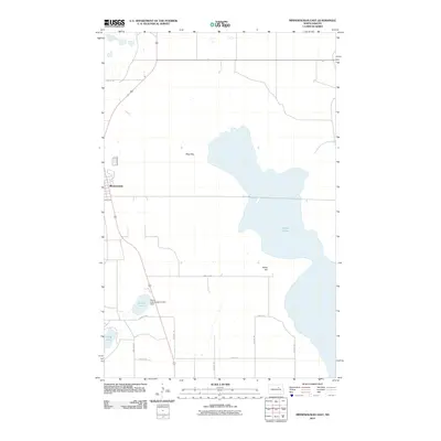
2011 Map of Minnewaukan East
USGS Topo · Published 2011About this map
Minnewaukan sits at the edge of the rising waters of West Bay, part of the sprawling Devils Lake system in Benson County. This 2011 survey illustrates a landscape dominated by shifting hydrology and civil engineering, most notably the Round Lake Outlet Control Dam located near the shore of Round Lake. The interplay between the expanding lake levels and the established grid of section roads like 45th St NE and 64th Ave NE reveals how the local infrastructure adapts to the prairie's natural basins. To the south, Long Lake and the elevation of Sams Hill provide the few breaks in the low-lying terrain, marking a region where the water's edge is a constant and defining presence for the community.
Find a feature on this map
17 named features on this map. Tap any name to fly to it.
Don’t see what you’re looking for? This feature index may not catch every label — zoom into the map to look around manually.
Map Details
Editions of this 2011 Minnewaukan East Map
This is the sole edition of this map. No revisions or reprints were ever made.
Other maps of this area

1931 · Oberon
USGS Topo · 1:62,500

1932 · Flora
USGS Topo · 1:62,500

1932 · Grahams Island
USGS Topo · 1:62,500

1950 · Grahams Island
USGS Topo · 1:62,500

1950 · Oberon
USGS Topo · 1:62,500

1951 · Crow Hill
USGS Topo · 1:24,000

1951 · Oberon
USGS Topo · 1:24,000

1951 · Grahams Island
USGS Topo · 1:24,000

1951 · Tilden
USGS Topo · 1:24,000

1951 · Minnewaukan East
USGS Topo · 1:24,000