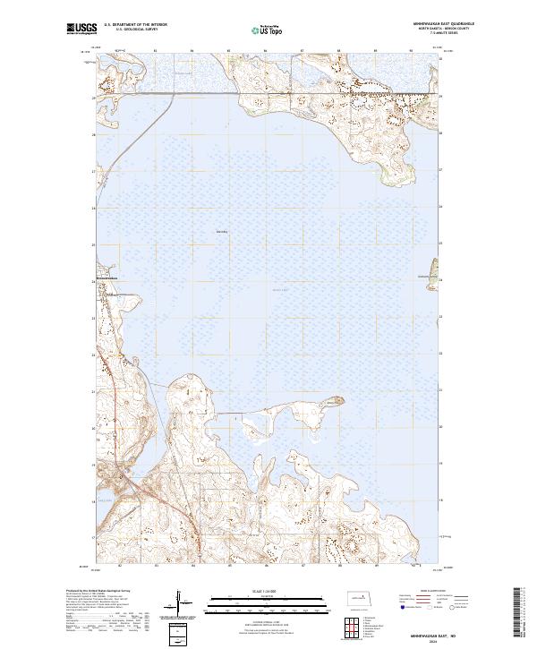
2024 Map of Minnewaukan East
USGS Topo · Published 2024About this map
Minnewaukan sits at the western edge of this landscape, positioned where the shoreline meets a network of local roads and highways. The map is dominated by the expansive waters of Devils Lake, specifically its West Bay, which surrounds several prominent landforms including Grahams Island and Sams Hill. This 2024 survey illustrates the complex, fluid boundary between land and water in this region, where the Benson County Waterfowl Production Area spans multiple sections to protect vital prairie wetlands. Beyond the main lake, smaller bodies of water like Pelican Lake and Long Lake dot the surrounding terrain, emphasizing the importance of this aquatic ecosystem. The infrastructure is characterized by rural routes such as US Hwy 281 and Old Hwy 281, which connect the small settlement to the broader North Dakota prairie.
Find a feature on this map
24 named features on this map. Tap any name to fly to it.
Don’t see what you’re looking for? This feature index may not catch every label — zoom into the map to look around manually.
Map Details
Editions of this 2024 Minnewaukan East Map
This is the sole edition of this map. No revisions or reprints were ever made.
Other maps of this area

1931 · Oberon
USGS Topo · 1:62,500

1932 · Flora
USGS Topo · 1:62,500

1932 · Grahams Island
USGS Topo · 1:62,500

1950 · Grahams Island
USGS Topo · 1:62,500

1950 · Oberon
USGS Topo · 1:62,500

1951 · Crow Hill
USGS Topo · 1:24,000

1951 · Oberon
USGS Topo · 1:24,000

1951 · Grahams Island
USGS Topo · 1:24,000

1951 · Tilden
USGS Topo · 1:24,000

1951 · Minnewaukan East
USGS Topo · 1:24,000