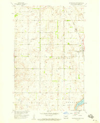
1958 Map of Minnewaukan West
USGS Topo · Published 1959About this map
Minnewaukan serves as the focal point of this late 1950s survey of Benson County, located at the junction of the Northern Pacific railroad and the northern reaches of West Bay. The landscape is characterized by the complex glacial topography of the Devils Lake basin, where numerous small wetlands and basins are scattered across the townships of McClellan, Riggin, Eldon, and Aurora. Genealogists will find significant value in the documentation of local burial grounds, including the Minnewaukan Cemetery, St Peter Cemetery, and the Free Church Cemetery. The map also captures the industrial footprint of the era through various Gravel Pits and the rail line that once connected these prairie communities to larger markets. To the southeast, the terrain transitions into the township of Oberon near the shores of Long Lake.
Find a feature on this map
22 named features on this map. Tap any name to fly to it.
Don’t see what you’re looking for? This feature index may not catch every label — zoom into the map to look around manually.
Map Details
Editions of this 1958 Minnewaukan West Map
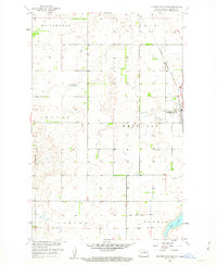
2 editions found
Other maps of this area

1931 · Oberon
USGS Topo · 1:62,500

1932 · Flora
USGS Topo · 1:62,500

1932 · Grahams Island
USGS Topo · 1:62,500

1950 · Grahams Island
USGS Topo · 1:62,500

1950 · Oberon
USGS Topo · 1:62,500

1951 · Oberon
USGS Topo · 1:24,000

1951 · Tilden
USGS Topo · 1:24,000

1951 · Minnewaukan East
USGS Topo · 1:24,000

1951 · Flora
USGS Topo · 1:24,000

1951 · Josephine
USGS Topo · 1:24,000