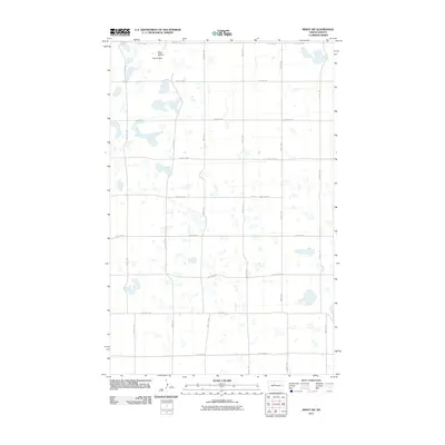
2011 Map of Minot SW
USGS Topo · Published 2011About this map
Twin Buttes rises as a prominent landmark in this prairie landscape of Ward County, where the terrain is punctuated by numerous small depressions and potholes characteristic of the region's glacial history. The 2011 survey reveals an orderly grid of section lines and gravel roads that define the rural character of the area southwest of Minot. Key corridors like 107th St SW and 177th Ave SW facilitate movement across this agricultural expanse, connecting isolated farmsteads and field access points. The pattern of development shown here reflects a late-twentieth-century rural infrastructure, where modern arterial routes like 219th Ave SW overlay the original township-and-range survey system. This map captures a moment in the early 21st century before significant shifts in land use or intensive energy development potentially altered the surface drainage and road networks of the North Dakota plains.
Find a feature on this map
19 named features on this map. Tap any name to fly to it.
Don’t see what you’re looking for? This feature index may not catch every label — zoom into the map to look around manually.
Map Details
Editions of this 2011 Minot SW Map
This is the sole edition of this map. No revisions or reprints were ever made.
Other maps of this area

1928 · Minot
USGS Topo · 1:62,500

1948 · Minot NW
USGS Topo · 1:24,000

1949 · Minot NW
USGS Topo · 1:24,000

1949 · Minot
USGS Topo · 1:24,000

1954 · Minot
USGS Topo · 1:250,000

1954 · McClusky
USGS Topo · 1:250,000

1958 · McClusky
USGS Topo · 1:250,000

1958 · Minot
USGS Topo · 1:250,000
1966 · Minot
USGS Topo · 1:24,000

1980 · Minot
USGS Topo · 1:100,000